Laser Scanning
At WGP Digital, we select the optimal scanning method based on your project’s scope — whether you’re documenting millimetre-level heritage detail or scanning large terrain efficiently.
Terrestrial Laser Scanning:
The technology has progressed rapidly, resulting in scanners that are faster, lighter and more accurate. Terrestrial scanners can now produce huge amounts of data in seconds. Laser scanners have become easier to use, however, for accurate survey data an understanding is required of the benefits and limitations of each of the scanners and the processing/registration software.
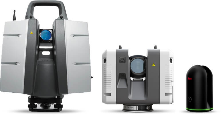
We always use the Leica range of terrestrial scanners and they have a wide range to suit different projects and outputs. Our go to scanner is either the Leica P40/P50 scanstation or the lightweight RTC360, both extremely accurate, fast and capturing very crisp 3d data.
Uses
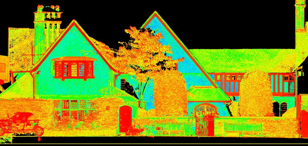
We would typically use a terrestrial laser scanner to survey large or complex measured building surveys whether it’s 2d or 3d, but we have used it for other projects including the monitoring of decorated fibrous plaster ceilings at the Institution of Civil Engineers in Westminster, this is an ongoing project and the first set of comparison data has been excellent. Laser scanners can also be used for confined spaces, large structures, quarries and even topographic surveys where it’s predominantly hard detail.
Terrestrial Laser Scanning vs LiDAR – What’s the Difference? Read below >>
Processing
Depending on the laser scanner used, the data is processed using Leica’s own Cyclone or Register 360, it’s extremely important that coordinated control is established, without the control the point cloud data cannot be relied on even though it may look correct. Beware of any surveyor relying totally on cloud to cloud registration.
Laser scan monitoring
We have successfully used laser scanning to monitor fibrous plaster ceilings within a large building in Westminster, London. This annual scan of the ceilings is a great way to quickly see of there is any movement, most of the ceilings are curved and the 3d point cloud is more effective way of showing any displacement.
Read the case study on the 3d monitoring project using laser scanning >>
LiDAR:
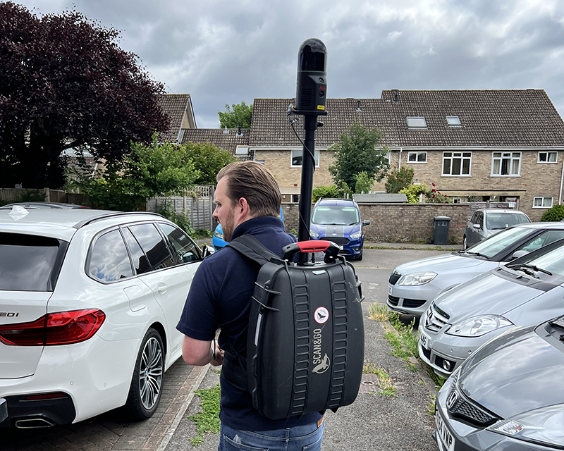
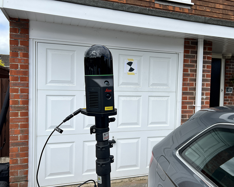
We’ve recently been testing the new portable/handheld laser BLK2GO and BLK-ARC, in particular the BLK-ARC which is very impressive with the ability to mount it on a wide-range of devices including backpack, tripod and yes robots!
Deliverables
The point cloud data can be registered and delivered as raw data in colour or mono in a wide range of formats, e57, lgs, ptx, pts etc. The data can even be meshed using Cyclone 3dr.
Other options include;
- Raw data in Autodesk Recap format, ready for import into Autocad, Revit, Civil 3D etc.
- Production of 2D or 3D Autocad drawings.
- 3D Building Information Models (BIM), usually Revit but other software can be used.
- 3D meshed models for use in 3DS max or other 3D modelling software.
Laser scan survey – Overkill?
For a lot of measured survey projects introducing 3d laser scanning may not be necessary, in some cases photogrammetry to capture the externals and traditional survey techniques is more cost effective and just as time efficient. However if the project is complex, large or highly detailed then a laser scan survey is a great investment, especially if the project develops, need another section or more detailing? This can often be captured within the original scans with no return to site required.
Terrestrial Laser Scanning vs LiDAR – What’s the Difference?
While both technologies use laser pulses to generate detailed 3D data, they are suited to different environments and applications. Here’s how we select the right technology based on your project’s challenges and objectives;
Terrestrial Laser Scanning (TLS)
Terrestrial Laser Scanning involves a high-precision scanner mounted on a tripod, capturing data from fixed positions. It is ideal for:
- Detailed architectural and heritage surveys
- Interior mapping and as-built documentation
- Projects requiring millimetre-level accuracy
TLS is often combined with photogrammetry, rectified photography, or BIM workflows to deliver comprehensive spatial records of complex structures.
TLS accuracy: ±2 mm at 10 m
LiDAR (Mobile or Aerial)
LiDAR, or Light Detection and Ranging, refers to scanning systems typically mounted on drones, vehicles, or handheld platforms. It is most effective for:
- Topographic surveys over large or inaccessible areas
- Woodlands and vegetated terrain where ground detail is still needed
- Infrastructure and corridor mapping, such as roads or riverbanks
- Measured building surveys, large buildings where there is a need to survey areas much quicker than using TLS
LiDAR offers fast, wide-area coverage and the ability to “see through” vegetation to detect the ground surface beneath.
LiDAR accuracy: ±5–10 cm across large areas
Get in touch for a free project consultation — we’ll recommend the most effective scanning method for your needs.
FAQ
The Leica P40 can capture up to 1 million points per second, the new RTC360 2 million points!
The P40 is typically 3 millimetres at a distance of 10 metres, but once you combine multiple setups this distance can be less.
If you require any further information or have a project in mind, please do not hesitate to get in touch…